LINKS
Main Menu
Site Map & Links
Map of Ojibway
History of Ojibway Prairie
|
LINKS
|
History of Ojibway Prairie
|
|
|
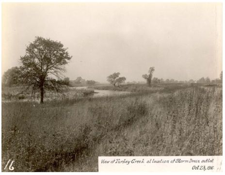
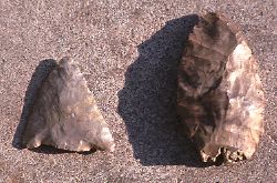 There is little known about the history of the area prior to European contact. Several prehistoric aboriginal sites are known from within a few kilometers of present day Ojibway Park. It is postulated that these seasonal camps were positioned in the wooded areas bordering the open expanse of the prairie where timber and water were more readily available. Most known sites are situated along Turkey Creek and its tributaries. Early explorers reported the presence of Huron Indian corn fields along the Detroit River.
|
1679 |
August 11, 1679: Father Louis Hennepin described the Detroit River shoreline as prairie-like parkland with elk, deer, bear, wild turkey and [Trumpeter] swan.
On October 8, 1701 the commandant of the new fort of Detriot wrote "There are such large number of swans that the rushes among which they are massed might be taken for lilies".
|
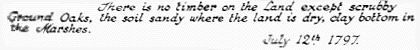
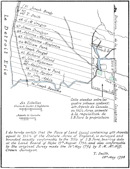
1749 | In 1749 the French were granted sections of land along the Ontario side of the Detroit River. It was known as Petite Cote. These farmsteads are a unique historical resource as this was the first major European farming community in Southern Ontario (Kenyon, 1976). These settlers farmed the land close to the river, the main transportation route, but probably had little impact on the prairie. Likely the lack of dense forest contributed to the initial choosing of this site for farming. However by 1790 Petite Cote was known as "la Cote de Misere" because the sandy soils quickly lost their fertility (Lajeunesse, 1960). | 1798 |
|
1823 |
The first naturalist to visit the prairie was David Douglas. In addition to collecting many species of plants he recorded the following incident on Saturday, September 20th, 1823: I got up in the oak 43 for the purposes of procuring seed and specimens; the day being warm, I was induced to take off my coat and in that state I ascended. I had not been above for five minutes up, when to my surprise the man whom I hired as guide and assistant took up my coat and made off as fast as he could run with it. |
1828 | [Greater Prairie Chicken] 'they have a grouse in the neighborhood of Sandwich tho not very common..' it was described as being confined to the "plains" and "of the most exquisite flavour" (Lumsden, 1966). The eastern race of the elk had become extinct by this time. | 1884 | The last local Trumpeter Swan was shot on Lake St. Clair. By this time much of the larger wildlife was gone and Passenger Pigeons were on their steep decline towards extinction. | 1892 | John Macoun, Dominion Botanist for Canada, visited the area on August 4, 1892. He discovered many new plants for Canada during his walk and proclaimed Ojibway as "a garden of rarities" and "the eastern extension of the prairie flora". | 1897 |
April 29, 1897. The last local record for Greater Prairie Chicken was a female bird shot on Fighting Island.
The Ojibway post office was founded in 1897. Presumably it was named after a band of native aboriginals that had a small settlement along the Detroit River at the foot of present day Sprucewood Ave. Ojibwa, or Chippewa, comes from the Algonquin word "otchipwa" (to pucker) and refers to the distinctive puckered seam of Ojibwa moccasins. There were 156,758 acres of forest remaining in Essex County.
|
1913 |
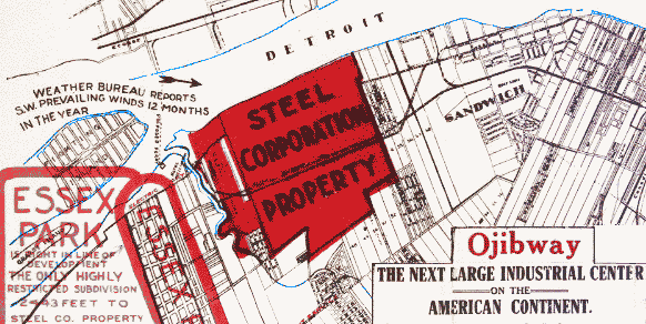
Ojibway became incorporated as a town in 1913. In the same year, the United States Steel Corporation purchased 1400 acres (567 ha.) for a huge steel plant. World War I stopped the development of the plant but the land was readied for development with the installation of concrete storm sewers and ditches. Ojibway was prepared to become a company town and plans were drawn for major residential growth.
|
1916 |
 |
1917 |
|
1937 | However the depression of the 1930's killed the project and the town's population never exceeded 100 (Today one can still find remnant sidewalks from this period in the woods at Brunet Park in LaSalle and Oakwood Park in Windsor). The Dominion Steel and Coal Company purchased the property in 1937 and some steel was produced. During World War II Ojibway was used as a testing ground for miltary vehicles. When the company shut down in 1957, the Canadian Salt Company purchased the property to mine salt. The failure to develop the land for industry or residential use allowed survival of large areas of prairie and woodland. | 1955 | Only 11,021 acres of forest remain in Essex County. | 1957 |
Ojibway Park was acquired by the City of Windsor in 1957 from the Canadian Salt Company in exchange for mineral rights beneath the Malden landfill site, even though the Park was located outside the city limits in the town of Ojibway. The by-law creating the park was passed on December 19, 1957. Prior to this time the park area was known as Yawkey Bush, named after a family that settled in the area in the 1800's.
On May 8, 1958 City Council adopted the following resolution: "That the 100 acre park in Ojibway be preserved as a natural park and woodland area and the Commisioner of Parks and Recreation be instructed to plan for its use a public picnic and family recreational area only." This was further reinforced by council's declaration in September that year that the park was "intended to be maintained as a natural park". The Park was formally declared on June 12th, 1961. In 1966 the Town of Ojibway was annexed by the City of Windsor. 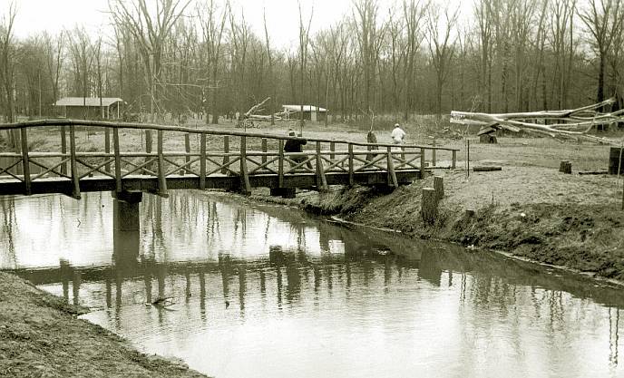
|
1965 | A large block of prairie was used for development of the Windsor Raceway. On opening night, 22 October, 5,136 patrons wagered $194,204 on their favourite horses. | 1968 |
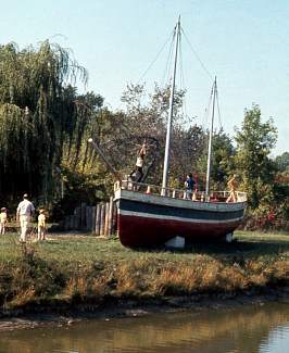
An old 20 ton tugboat named "Maudie" (built in Windsor in 1921) was moved to Ojibway Park and placed next to the creek to be used as a play structure for children. It remained in the park until 1990.
 |
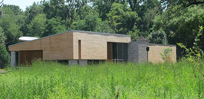
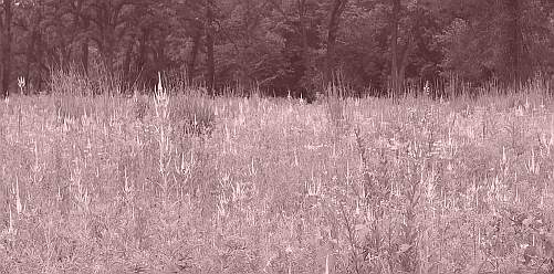
1969 | Dr. Paul Maycock visited the prairie next to Ojibway Park in October 1969 and wrote "This prairie is phenomenal. The tract appears largely untouched which seems nothing short of a miracle. To walk through the dense sward of grasses and find so many different types of plants which are generally unfamiliar to Ontariens because of their restricted distribution in the province, is an unforgettable experience..." Over the next two years many individuals and organizations in Ontario and Michigan petitioned the provincial government to protect this site. | 1973 | Acquisition for the Ojibway Prairie Provincial Nature Reserve began in 1973 with the purchase of 70 hectares (174.3A) from the Morton Salt Co. of Canada. A 65 ha portion was legislated under the Provincial Parks Act on August 30th, 1977. An additional 40 ha will be acquired for future expansion of the reserve. The Nature Conservancy of Canada assisted in the purchasing of lands for the Nature Reserve. | 1975 |
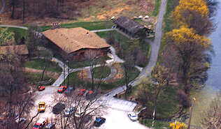
Construction of the original Ojibway Nature Centre began in 1974 with the transport of two portable classrooms from St. Clair College to the park. The building was formally opened in 1976.
|
1978 | The first prescribed burn is carried out in the provincial nature reserve. | 1979 | The local population of Northern Bobwhite was killed off by severe winter storms. | 1987 | Black Oak Heritage Park was acquired as part of the City of Windsor's purchase of lands from the Canadian Salt Company. A portion of the land which included the most significant woodland was set aside for parkland. | 1989 | Windsor's first Virginia Opossum was found behind a muffler shop on Tecumseh Road. Opossums had recently became established in nearby Kent and Elgin counties. | 1990 | Land for Tallgrass Prairie Heritage Park was purchased by the Ontario Heritage Foundation and dedicated in May 1990. | 1991 | In 1991 Ojibway Park was expanded to include an adjacent 20 ha oak woodland formerly owned by the Windsor Raceway. Funding for the "Joy Woods" acquisition was provided by the Nature Conservancy of Canada. The park now totals 66 ha (164 A) in size. | 1996 | Virginia Opossums quickly became common and widespread throughout the Windsor region. | 1999 | The City of Windsor announced a plan to acquire Spring Garden ANSI, the largest unprotected portion of the Ojibway Prairie Remnants Area of Natural and Scientific Interest (ANSI). | 2002 | The Emerald Ash Borer, an exotic beetle from Asia, is discovered for the first time in Canada on the west side of Windsor. Hundreds of ash trees in the Ojibway area are infected and there is concern that it will be very difficult to keep this insect from spreading throughout the province. | 2008 |
 The last block of the 300 acre Spring Garden Natural Area has been acquired by the city with assistance of funding from the federal Habitat Stewardship Program. The last block of the 300 acre Spring Garden Natural Area has been acquired by the city with assistance of funding from the federal Habitat Stewardship Program.
|
2010 |
A new 8,000 sq. ft. nature centre was built to replace the aging structure. It opened in the spring of 2011.
|
Kenyon, Ian T. 1976. Ojibway Prairie Reserve Archaeological Survey, 1976. Ontario Ministry of Culture and Recreation. 41pp. Lajeunesse, E.J. 1960. The Windsor Border Region. Univ. Toronto Press. 374 pp. Lumsden, H. G. 1966. The Prairie Chicken in Southwestern Ontario. Can. Field Nat., Vol. 80: 33-45 Macaun, J. 1893. Notes on the Flora of the Niagara Peninsula and Shores of Lake Erie. Hamilton Assoc. Jour. Proc. 9: 78-86. |
|
Please cite this page as: History of Ojibway Prairie (Version APR2024). Ojibway Nature Centre. Department of Parks & Recreation, Windsor, Ontario. http:///www.ojibway.ca/history.htm |
 |
To send comments or questions: Information last updated : April 2024 URL of this page: http://www.ojibway.ca/history.htm Copyright © 1999-2024. All rights reserved. You are on a City of Windsor Web Site. |
|